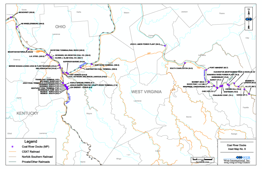
U.S. Coal Map - Southern Appalachia, COAL RIVER DOCKS
WEIR Presents the 2013 Edition of the U.S. Coal Industry Infrastructure Map
Mines - Transportation - Consumers - Southern Appalachia, Coal River Dock MapNo. 9 Detail
Back to U.S. Map
- Topographical Base with Coal Fields and Year 2013 Tabulated Data
- The map now provides the location of coal river docs located along the inland waterways of the United States. The enclosed reference book, Coal River Docks, includes pertinent data relating to the facilities, along with inset maps showing the location of coal docks.
- Size:
- 70.0 x 43.0 inches with tables on each side of the map, Coal dock data and detailed maps as a separate document
- Price:
- US $150.00 + Shipping costs
- Contact Us to Order
- Selected areas of the map are also available by request
Partial View of Tabulated Data
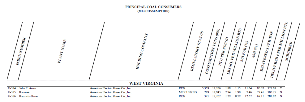
Coal Burning Industrial and Utility Plant Consumers
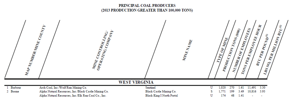
Mines Producing Greater than 100,000 Tons Annually
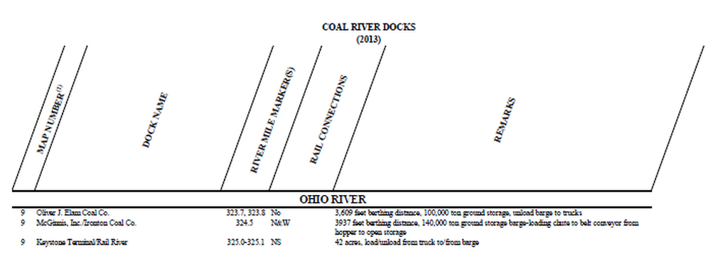
Partial View of Coal River Docks Booklet